
Blizzard coming to eastern Idaho Thursday night; drivers asked to not travel
Published at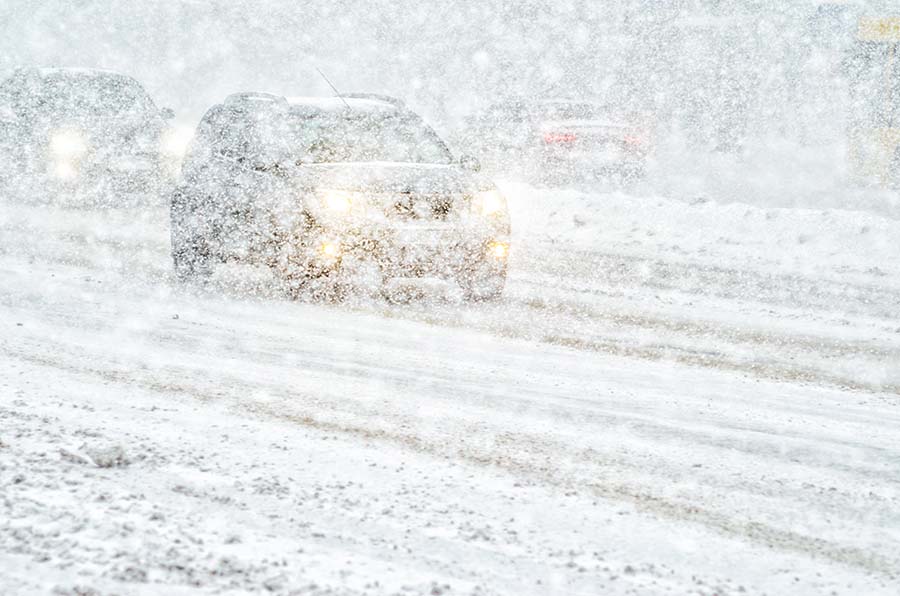
POCATELLO — A blizzard is coming to eastern Idaho, bringing significant snowfall and high winds throughout the region starting Thursday evening.
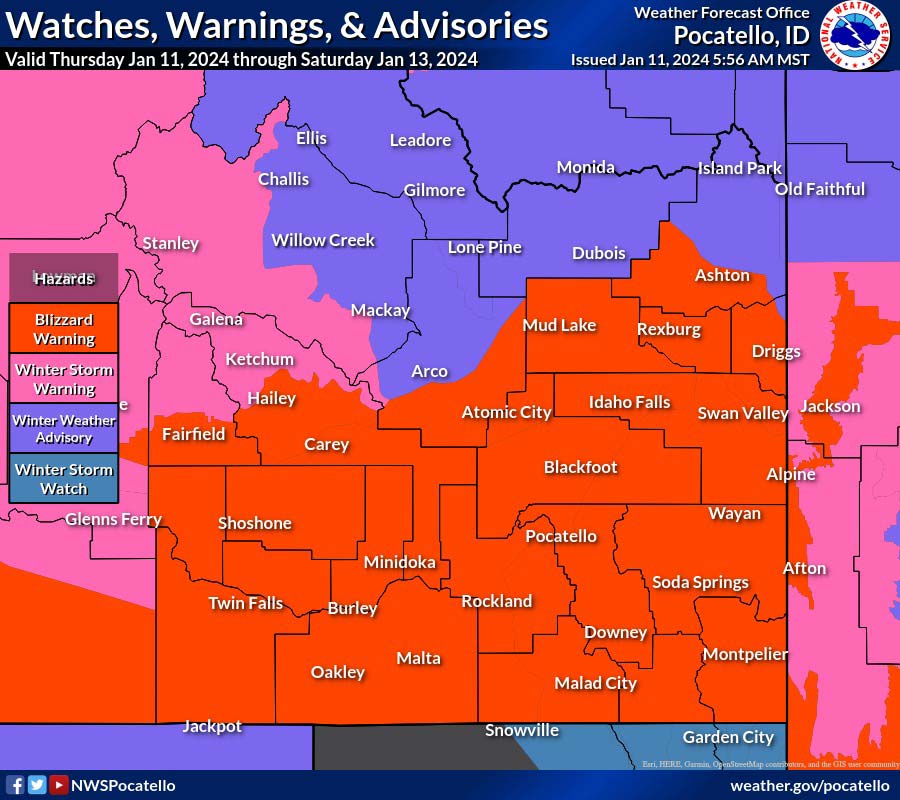
The National Weather Service in Pocatello has issued a blizzard warning starting 5 p.m. Thursday and will last until Friday evening or Saturday morning in certain areas.
NWS Meteorologist Audra Moore said the last blizzard warning that was issued was eight years ago in eastern Idaho during December 2016. She said there have been about seven blizzard warnings issued since 2006.
“We are trying to get people to understand how serious this is,” Moore said. “A blizzard is sustained winds or frequent gusts of 35 mph or greater causing blowing snow to reduce visibility to a quarter of a mile or less for 3+ hours. So a blizzard warning is less about the snow falling than it is about the blowing snow impacting travel.”
Blizzard conditions are expected all across eastern Idaho, with total snow accumulations of one to five inches in the Upper Snake River Plain. The snowfall and wind is expected from 5 p.m. Thursday to 5 p.m. Friday. Areas affected include the Mud Lake, Teton Valley, Idaho Falls, Rexburg, St. Anthony, Victor, Ashton, Tetonia and Driggs.
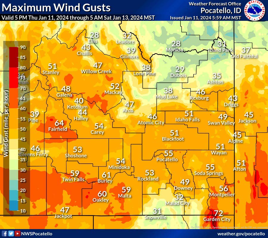
Places like Pocatello, Fort Hall, Shelley and Blackfoot could expect snow accumulations of four to eight inches and winds gusting as high as 60 mph. In these areas, the blizzard warning is in effect from 5 p.m. Thursday to 5 a.m. Saturday.
Places like Inkom, Lava Hot Springs, Preston, Montpelier, Soda Springs and Swan Valley could have five to nine inches of snow. The blizzard warning in these areas is also in effect from 5 p.m. Thursday to 5 a.m. Saturday.
Additionally, there is a wind chill watch in effect from Friday through Saturday. Winds gusting as high as 55 mph are possible. Dangerously cold wind chills are possible, with chills as low as 25 below zero.
“Tomorrow (Friday) morning would be a nightmare travel scenario with gusts in that 50 to 60 mph range,” Moore added.
The blizzard warning from NWS says that travel could be very difficult to “impossible.” Blowing and drifting snow will significantly reduce visibility. In a graphic posted by NWS, the blizzard warning advises, “do not travel.”
“It’s way too dangerous. Don’t be out unless it is an emergency. Not only are you putting yourself at risk, but you also put at risk the lives of the emergency responders,” Moore said.
If you have to travel, Moore suggests doing it on Thursday before the blizzard warning is in effect.
“Make sure you’ve got your snow gear in the car with you and make sure you’ve got extra food, extra water, flashlights, and power banks to charge your phone,” she added.
Click here to check out the road conditions. Click here to view the weather in your area.
This weather-related story is brought to you by Frontier Credit Union. At Frontier Credit Union, we believe in building a better life for our members, our communities and the great state of Idaho. Explore our solutions and start building your better life today at Frontier Credit Union.